Intermediate
Arduino Location Tracker using SIM800L GSM Module and NEO-6M GPS Module
30-Second Elevator Pitch: Arduino GPS Tracker
30-Second Elevator Pitch: Arduino GPS Tracker
▶ Click to play project demo
Project Supporter Team
Posted by
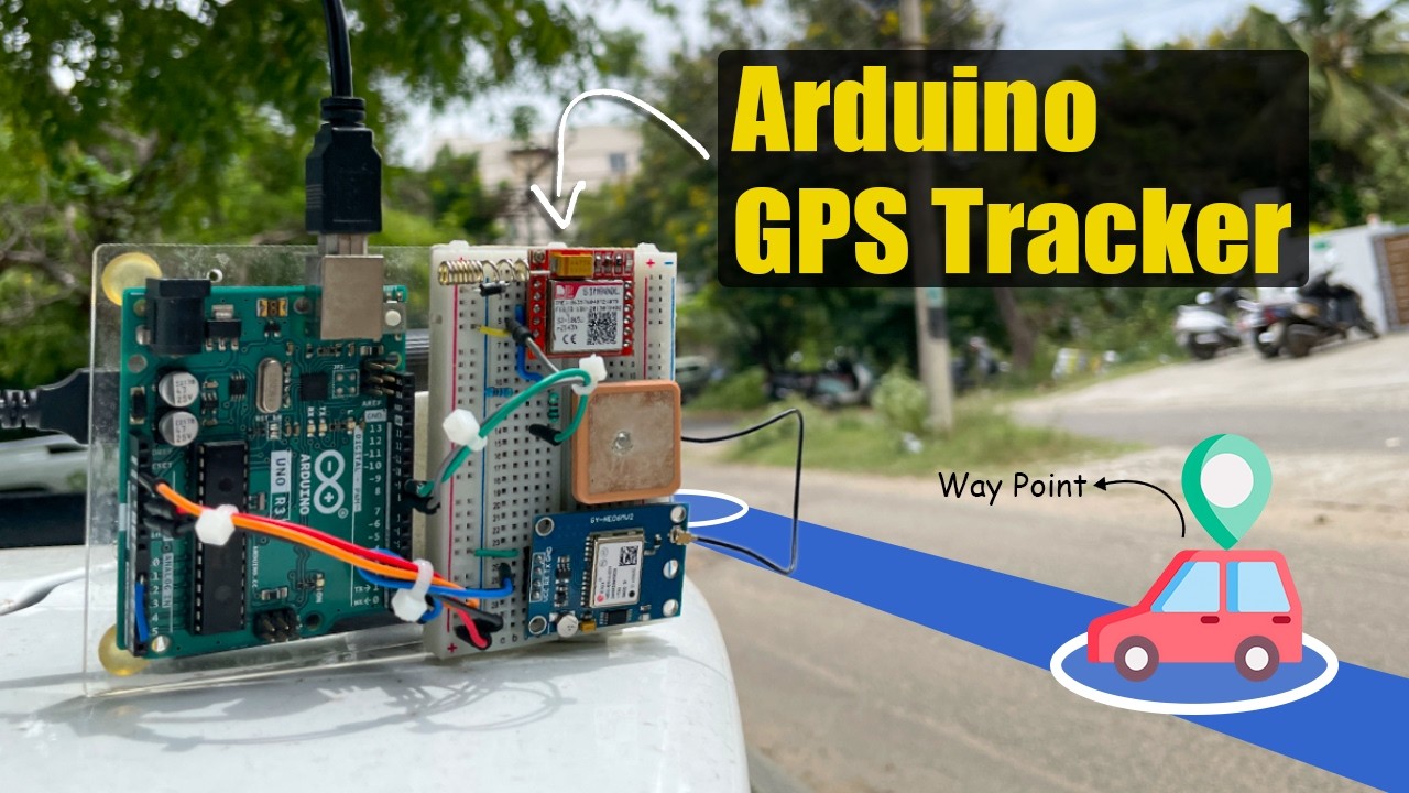
This project implements a sophisticated location monitoring solution by integrating the NEO-6M GPS module with SIM800L GSM technology on an Arduino Uno platform. The system captures precise GPS coordinates using satellite triangulation, processes the data through the Arduino's microcontroller, and transmits real-time location updates via 2G cellular networks. By leveraging AT commands for GSM communication and NMEA protocol parsing for GPS data extraction, the tracker achieves sub-10-meter accuracy while maintaining low power consumption. The embedded system features automated SMS alerts, remote query capabilities, and can be easily integrated with web-based mapping APIs for comprehensive asset tracking applications. This IoT-enabled solution demonstrates practical implementation of embedded systems, wireless communication protocols, and geolocation services in a compact, cost-effective package suitable for vehicle tracking, personal safety devices, or remote asset monitoring applications.
Real-time GPS coordinate acquisition, GSM/GPRS data transmission, Arduino-based embedded control, UART serial communication, and scalable IoT architecture.
NEO-6M GPS Module → Captures satellite coordinates
Arduino UNO R3 → Processes GPS data and controls communication
SIM800L GSM Module → Transmits location data via 2G cellular network
GeoLinker Cloud → Stores and displays tracking data online
1. GPS Data Acquisition
NEO-6M continuously receives satellite signals and outputs NMEA-formatted location data
Arduino reads this GPS data through serial communication (Pin 0)
2. Data Processing & Mode Switching
Due to Arduino UNO's limited 2KB RAM, the system uses automatic mode switching
Pin 2 connected to RST enables switching between GPS mode and GSM mode
This prevents memory corruption from handling both GPS parsing and GSM HTTP requests simultaneously
3. Cellular Transmission
SIM800L connects to a 2G network using carrier APN settings
Location data gets transmitted to the GeoLinker Cloud platform via GPRS
The system includes retry mechanisms for failed transmissions
4. Cloud Integration
GeoLinker Lite library handles all communication protocols
Data appears on the CircuitDigest Cloud dashboard for real-time tracking
Supports up to 100,000 data points per free account
Power Requirements:
Voltage Level Protection:
Memory Management:
For more Technical information, you can check our source on the Arduino GPS Tracker Project.
Support to get the Source Code for this project
Verified user reviews
ล็อกอินด้วยบัญชีบนเว็บนี้แล้วให้คะแนนหรือคอมเมนต์ได้เลย ระบบเก็บผ่าน Supabase ไม่ต้องใช้ GitHub แล้ว
ยังไม่มีรีวิวที่อนุมัติแล้ว เป็นคนแรกที่มาให้ความเห็นได้เลย