The collection of environmental information is important for several areas. Monitoring equipment makes it possible to analyze the environment in order to predict events and make better decisions. One of the examples is for fires, which increasingly destroy dozens of hectares of fauna and flora, negatively impacting the entire world. These are becoming more frequent, faster and more difficult to extinguish.
Unmanned aerial vehicles (also known as drones) allow increased mobility of sensory equipment, being able to reach hard-to-reach places. Equipment can be attached to the drone and weather information can be captured from kilometers away. As such, we decided to implement a mobile weather station using drones. With this station it is not only possible to know data about the environment, but also the risk of fire is calculated at every moment.
PROJECT
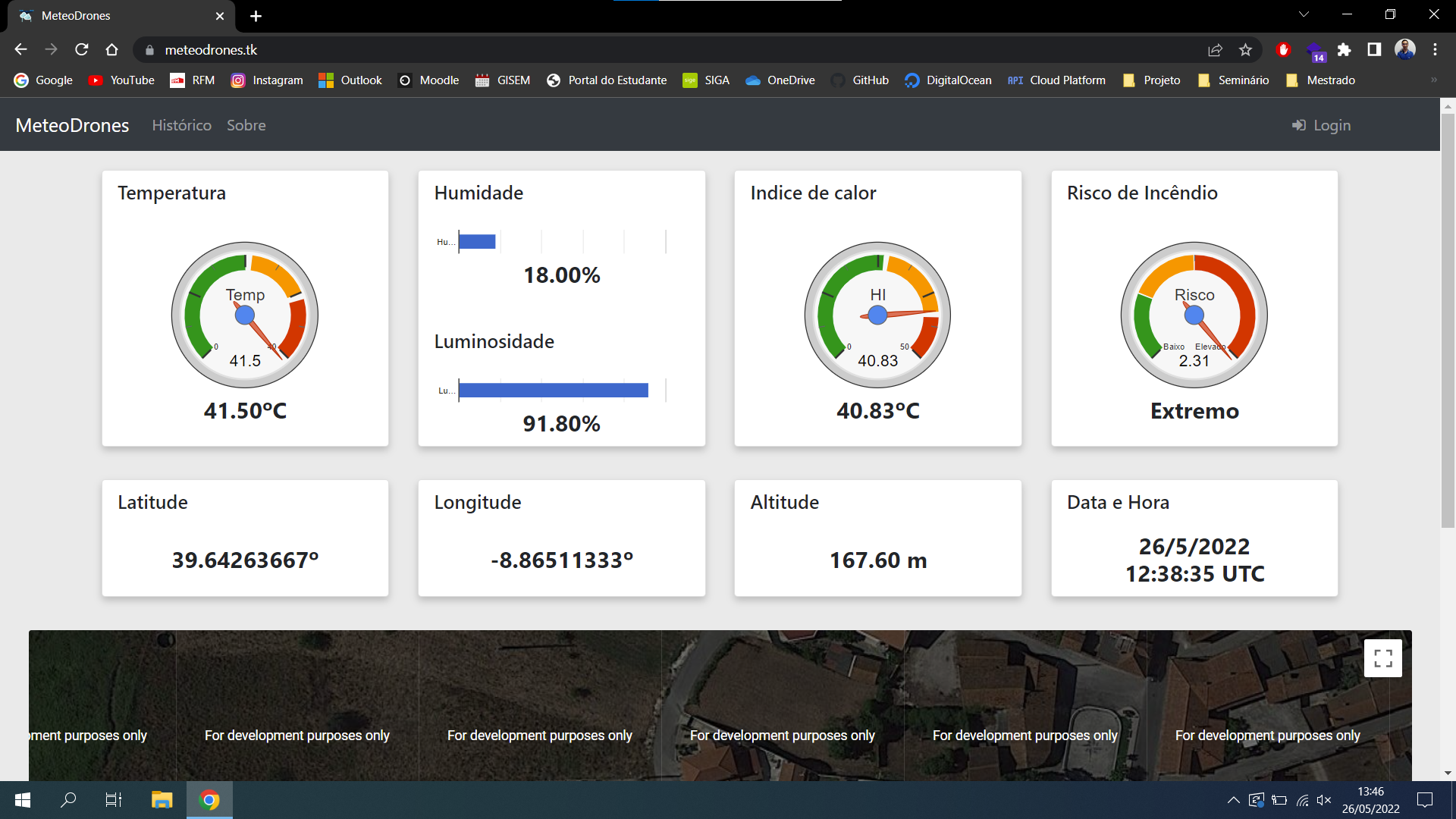
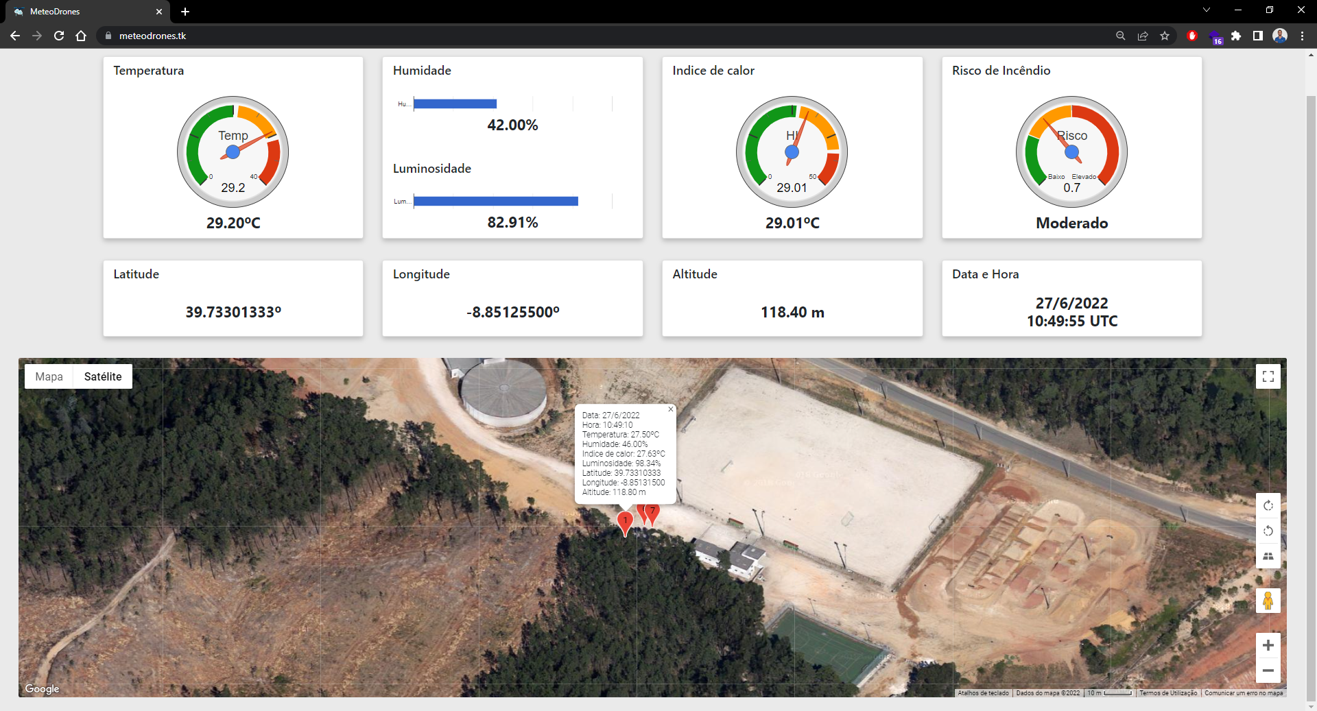
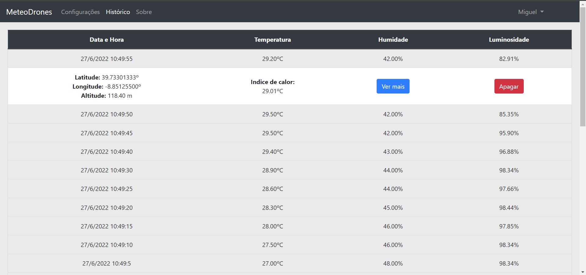
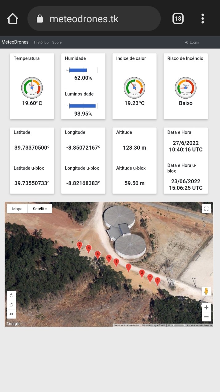
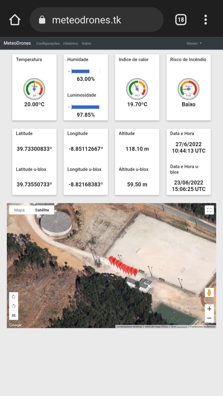
We decided to equip a drone with sensory equipment that is connected to a processing module. Through a web platform it is possible to view the captured meteorological data, as well as a map that shows the path taken by the drone in real time. It is also possible to consult the entire history and the risk of fire is calculated for each moment. It has an authentication mechanism where an authenticated user can change the method of sending information from the drone to the platform, through time or distance. This platform presents the data through graphs for easier and faster interpretation of weather information.
It is possible to view:
- Temperature;
- Humidity;
- Luminosity;
- Heat Index (felt temperature);
- Risk of fire;
- Geographic coordinates;
- Date and time;
- Map with the last 9 coordinates of the route taken by the drone.
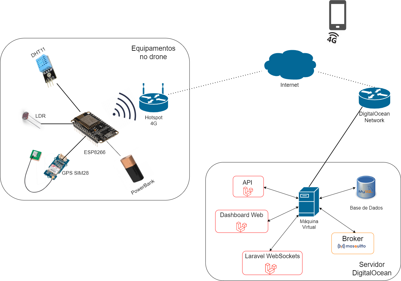
The following image shows a schematic of the prototype developed and the communication technologies used.
Aerial Environmental Telemetry Hub
This advanced project mounts a high-fidelity weather station on a drone, allowing for the collection of atmospheric data at various altitudes and locations.
- On-Drone Sensor Fusion Kernel: The Arduino captures Temperature, Humidity, and Altitude (via barometric pressure) and logs them to an SD card with a 10Hz sampling rate.
- Telemetry Serial Broadcast: Sends the real-time weather data back to the ground station via a 433MHz or 2.4GHz RF link. This allows the pilot to monitor the "Atmospheric Column" from the ground.
Efficiency
- VS Code Optimized: The firmware was developed in VS Code to optimize the drone's power usage and ensure the sensor-broadcast loop doesn't interfere with the drone's flight controller.
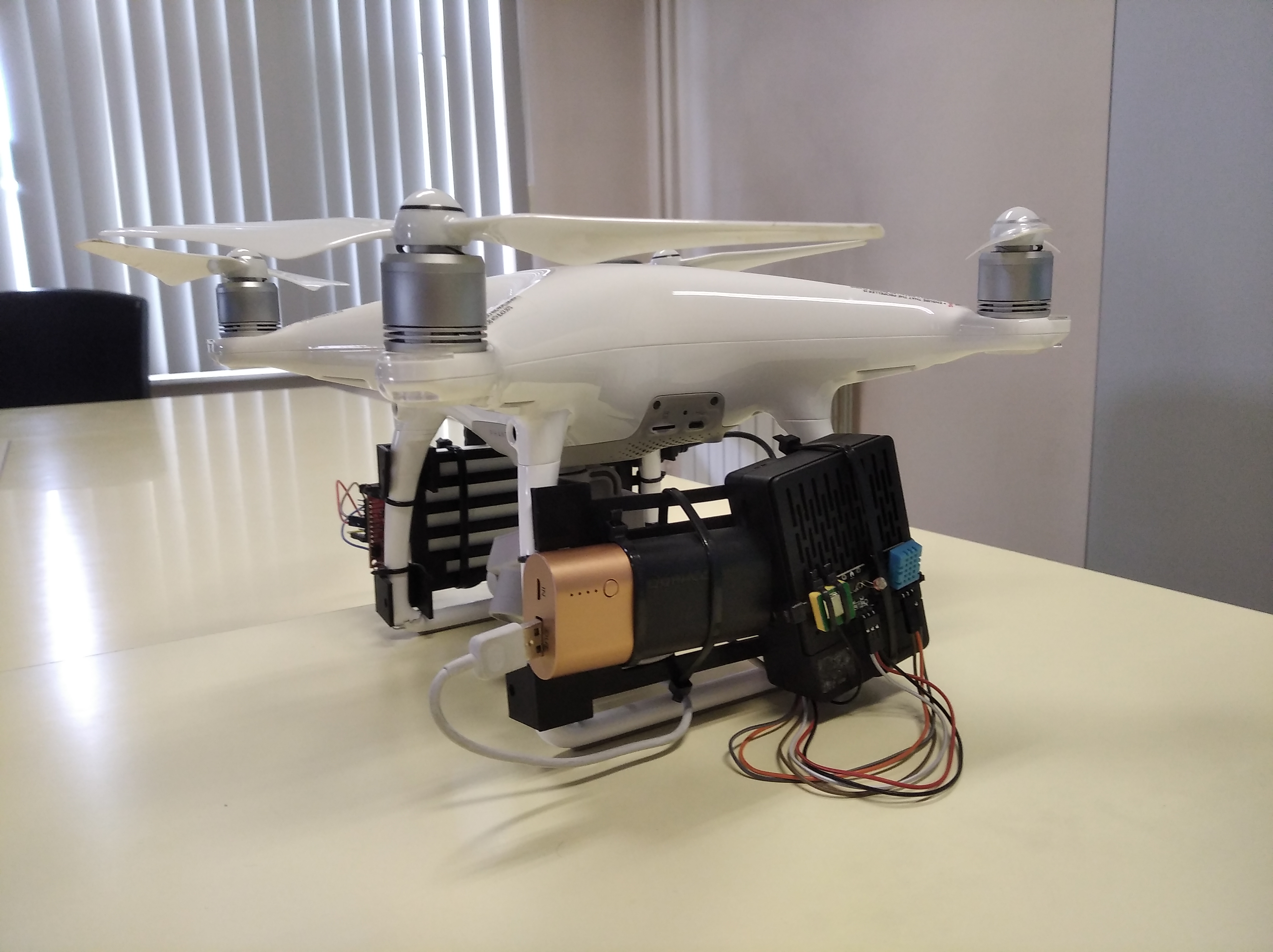
PROCESSING MODULE
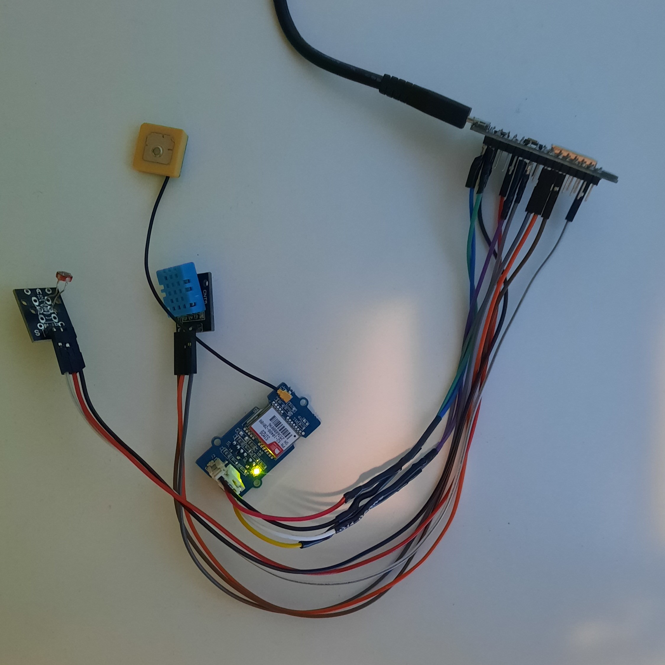
The DHT11, LDR and GPS module are connected to an ESP8266 with Wi-Fi or Arduino MKR1000. This module saves the data captured by the sensors, creates a JSON file and sends a POST request with the weather data to the web platform, through the API provided.
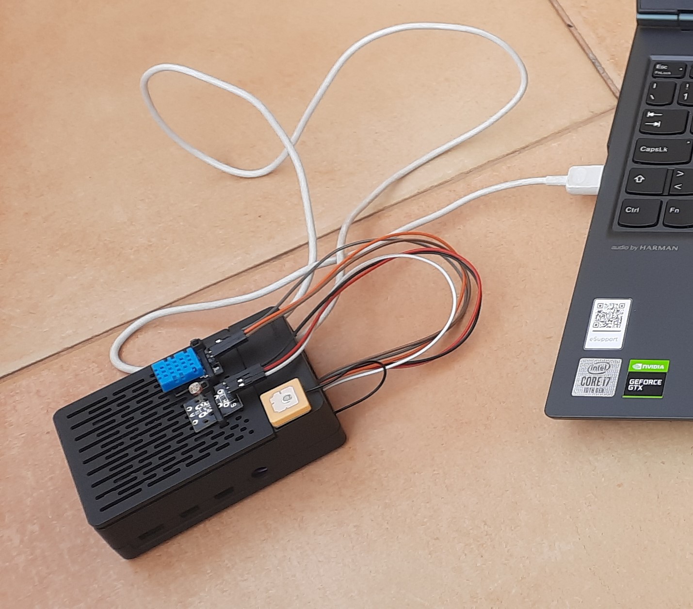
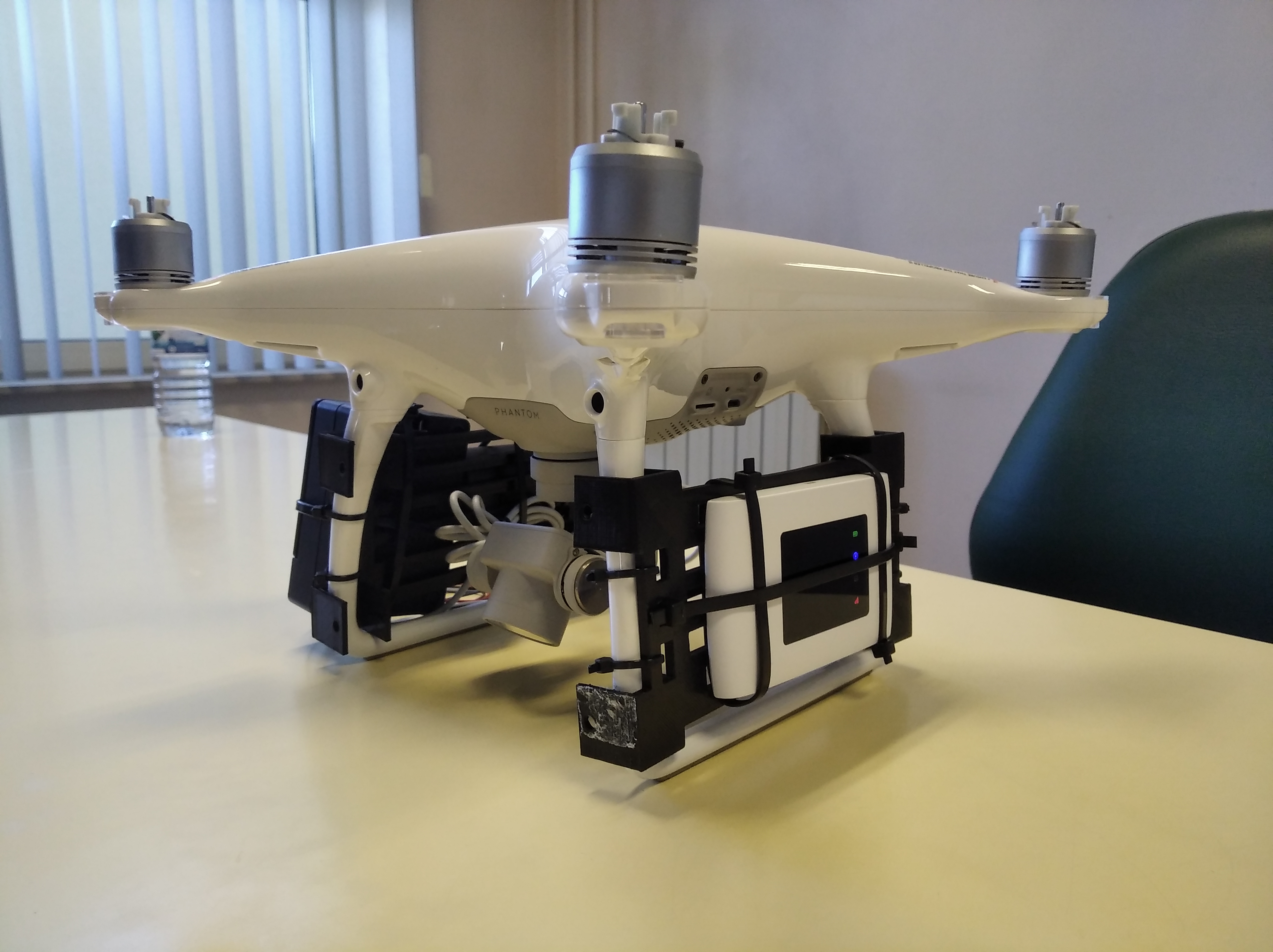
In order to facilitate transport and assembly on the drone, all equipment was placed inside a Raspberry Pi 4 box.
WEB PLATFORM
The website is on a server hosted by DigitalOcean and can be accessed via the URL meteodrones.tk. This was developed using the Laravel framework. It has API's for sending and receiving meteorological information and an authentication mechanism.
An authenticated user can change the method of sending information from the drone to the website by time interval or by distance traveled.
DRONE
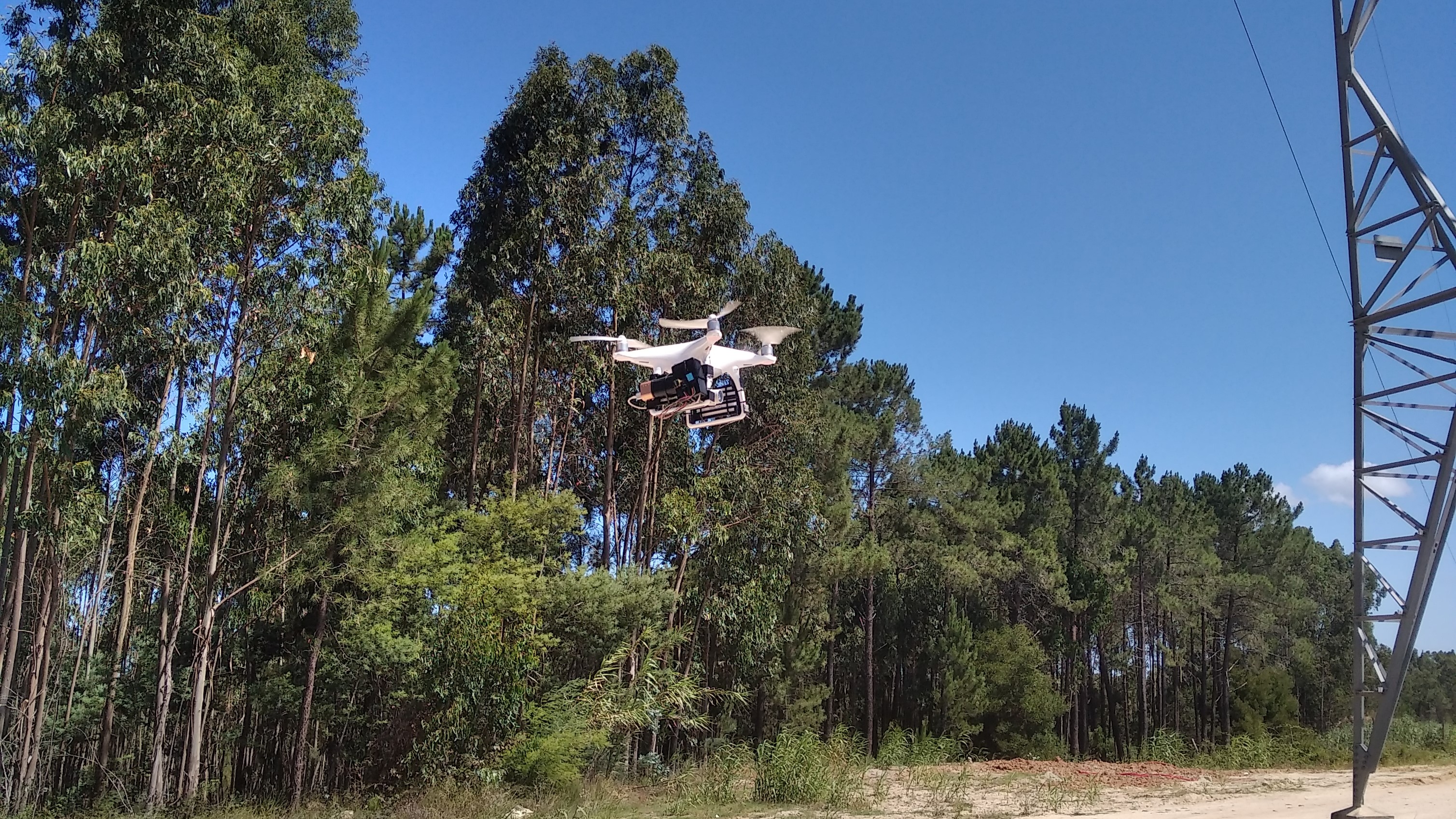
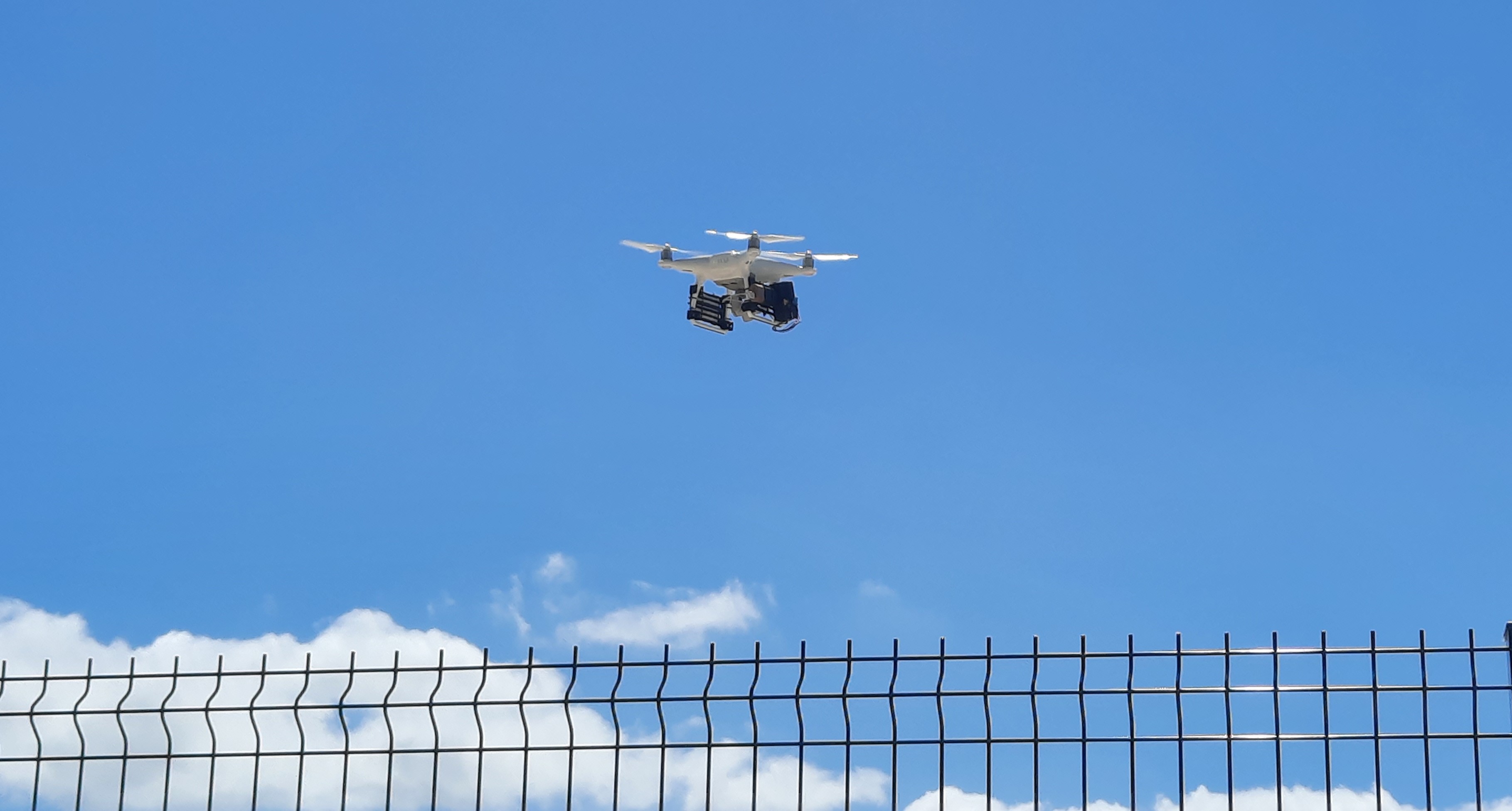
In order to have a Wi-Fi connection on the drone, it was necessary to add a 4G hotspot. All equipment was coupled to a DJI Phantom 4 on supports printed on a 3D printer.
FLIGHT AND RESULTS
Tests carried out in a controlled environment in Parceiros, Leiria, Portugal.
FINAL NOTES
Equipment can be attached to any type of drone.
One problem with this project is Wi-Fi communication. The drone remote control operates in the same frequency range as Wi-Fi (between 2.4 GHz and 5.8 GHz, according to the manufacturer's website). When the drone moves too far from the command, the processing module stops sending the information to the web platform, due to interference. One solution would be to use LoRa technology.
Despite this, this solution allows the acquisition of meteorological data in places that are difficult to access, since the equipment is coupled to a drone, being able to reach places where neither people nor terrestrial machines could reach there. It is very useful for the detection and prevention of forest fires. A great advantage of this solution is that it uses simple, easily accessible, low-cost equipment and, due to its simplicity, anyone can implement this project, whether for personal or professional use. In addition, it is possible to view the information in real time through any computer, mobile phone or tablet, as long as it has an internet connection.
Work developed within the scope of the "Projeto Informático" Curricular Unit of the degree course in Computer Engineering at ESTG of Polytechnic of Leiria.