IDEA
This project will keep track of the numerous vehicle running in various routes.This project also alerts the authorized person in case of any emergency situation like breakdown, accidents etc by notification. And by the notification we can also give the precise location of vehicle for immediate assistance.
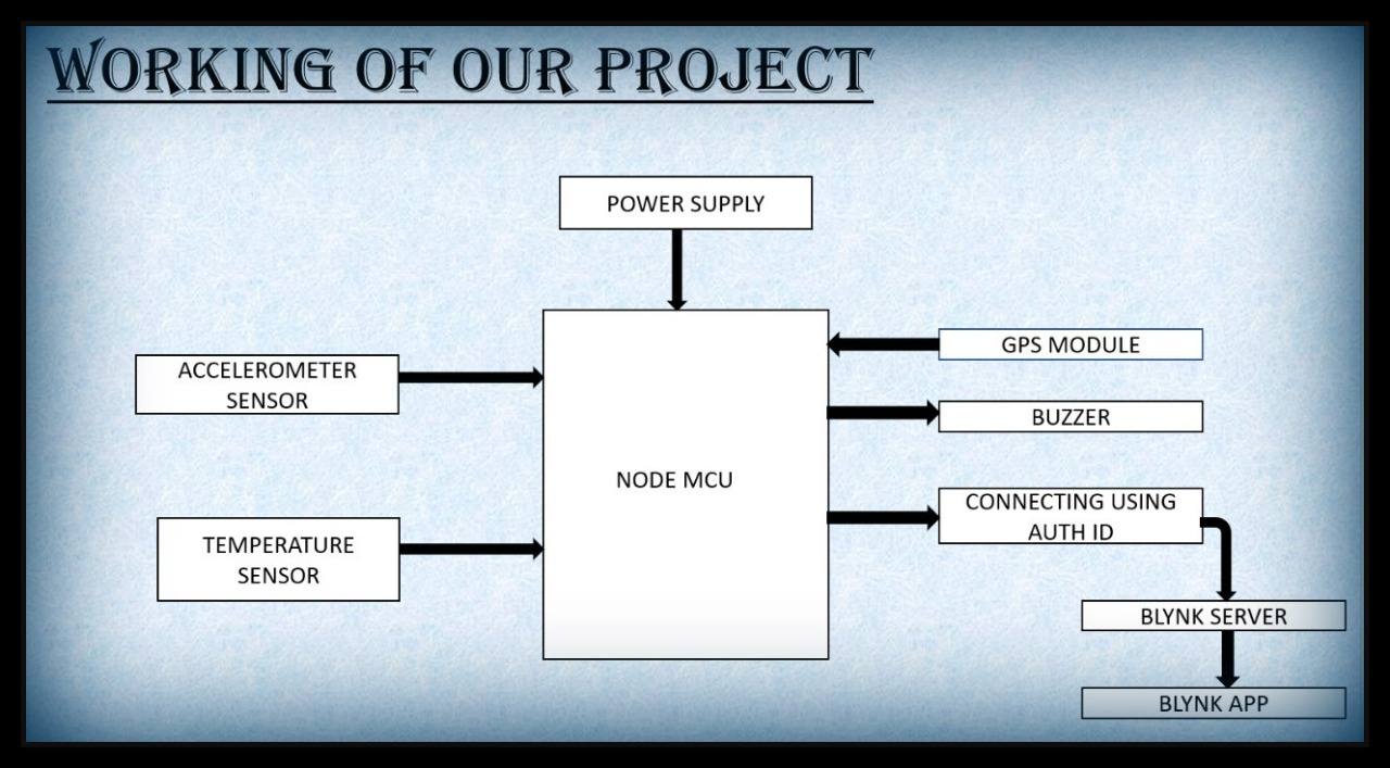
WORKING
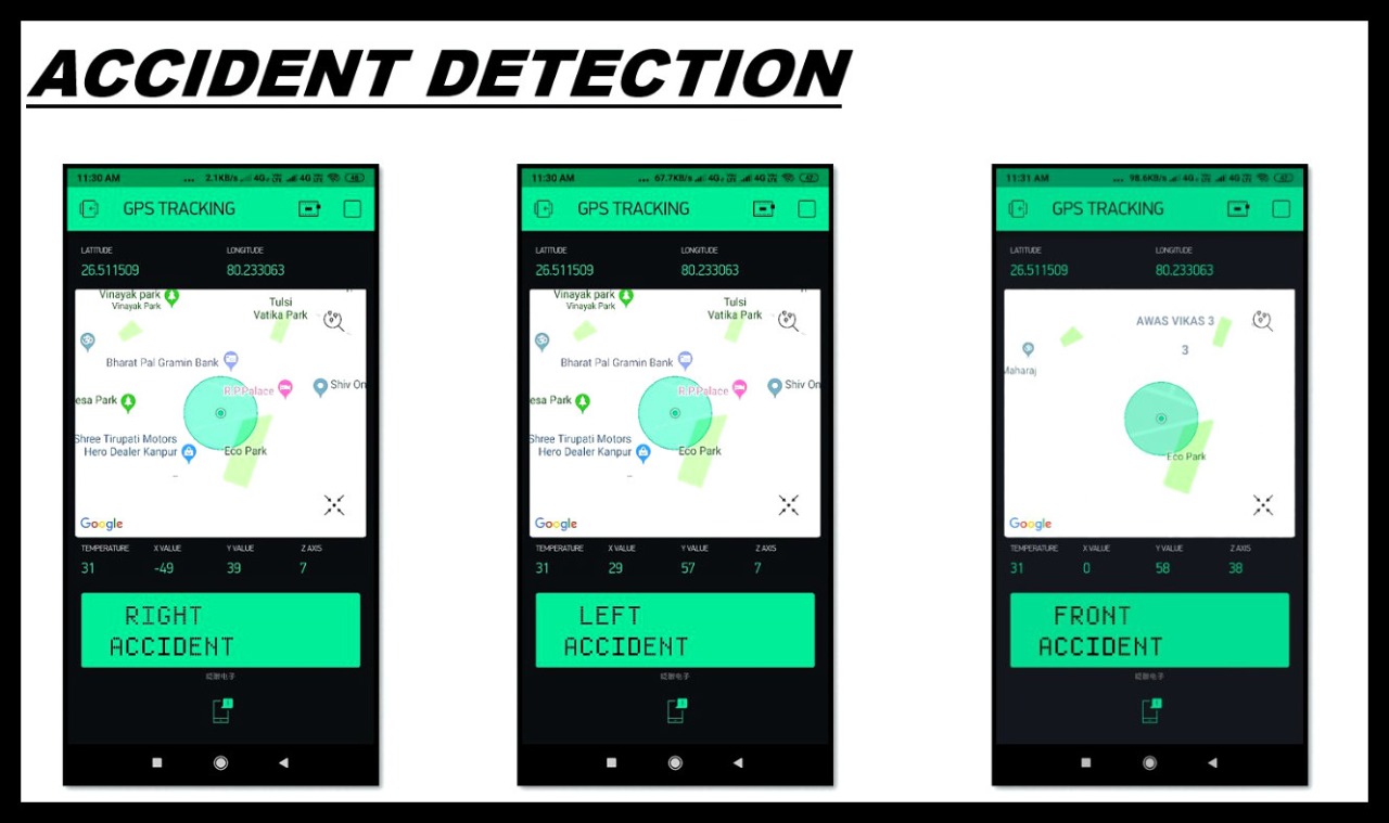
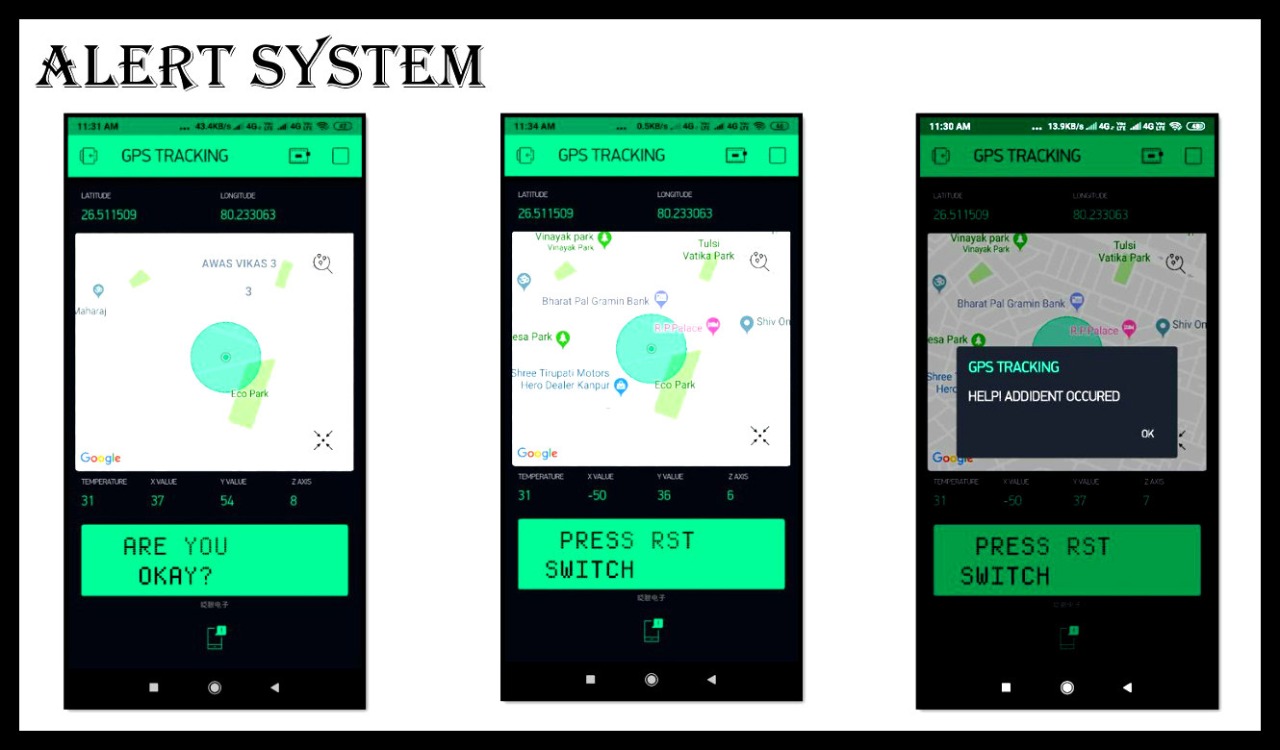
Values displayed on the application:
- Latitude and longitude value
- google maps.
- Temperature value
- X, Y and Z coordinates
- LCD
INTERFACING GPS WITH NODEMCU:
- The GPS module is connected to Node MCU.
- The Power is given to NodeMCU by battery and the NodeMCU starts the WIFI.
- The GPS module takes some time to capture location details once it is powered on.
- The GPS module receives the data from satellite and gives output in standard string format.
- The string contains different parameters separated by commas like longitude, latitude, altitude, time
- It provides output serially on Tx pin with default 9600 Baud rate.
- The NodeMCU gets the output and send to the blynk App
EXPANDED TECHNICAL DETAILS
GPS-to-Cloud Asset Tracking
This project creates a real-time vehicle tracker that displays the location, speed, and heading on a customized smartphone map.
- NMEA Protocol Decoding: The Arduino interfaces with a NEO-6M GPS module. The firmware uses the
TinyGPS++library to decode the raw NMEA strings into easy-to-use Latitude, Longitude, and Altitude variables. - Blynk IoT Mapping: Uses an ESP8266 or GSM shield to transmit the GPS coordinates to the Blynk mobile app. The app's "Map Widget" instantly updates the vehicle's position, providing a professional tracking experience.
Efficiency
- Motion-Triggered Reporting: Includes a sleep mode that only transmits data when the GPS altitude or location changes significantly, drastically reducing data usage and power consumption.